01 / BIM
An overview of the stand
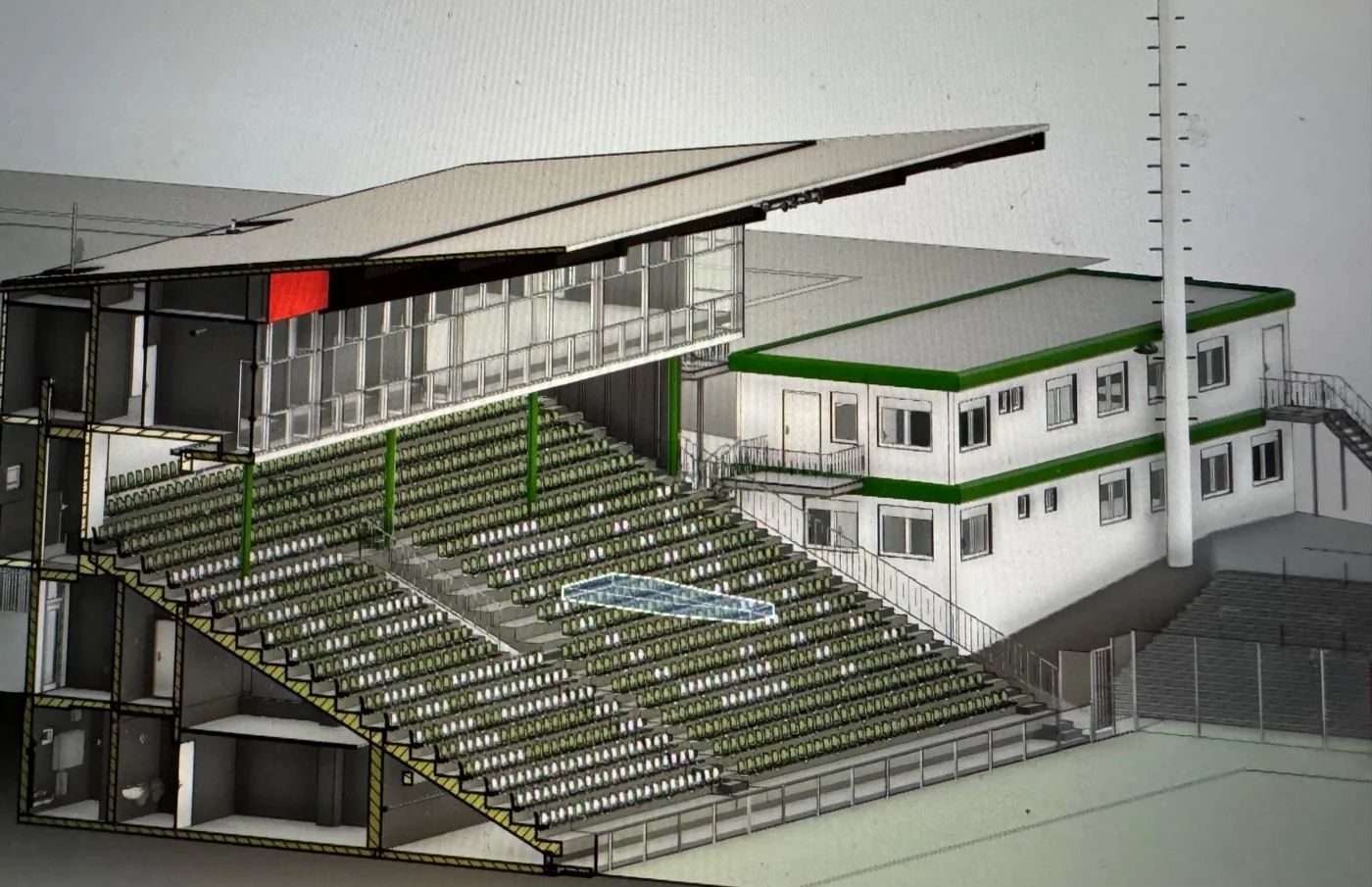
The stand in BIM: view building components and spatial relationships together.
 Enlarge view ↗

Reference / GeoScan ONE
80,000 m² of surveyed area, indoors and outdoors: RGB imagery, thermography and 3D laser scanning were used to digitise the VfB Lübeck site.
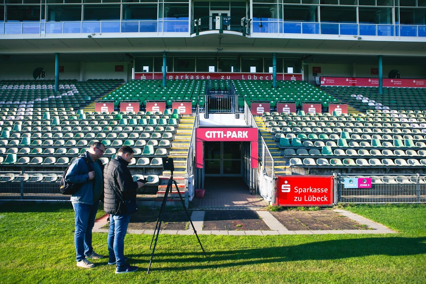
Project figures and media from GeoScan’s VfB Lübeck materials.
Stands, interiors and outdoor spaces form one stadium site. Digital capture brings these areas together in a spatial information base. The project film and model views show the journey from the physical site to a useful BIM model.
BIM model, 3D/2D construction plans, virtual 3D tour, 3D print and ESG reports.
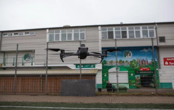
RGB images, thermography and 3D laser scanning capture existing conditions. Drone images add perspectives on the buildings and outdoor areas.
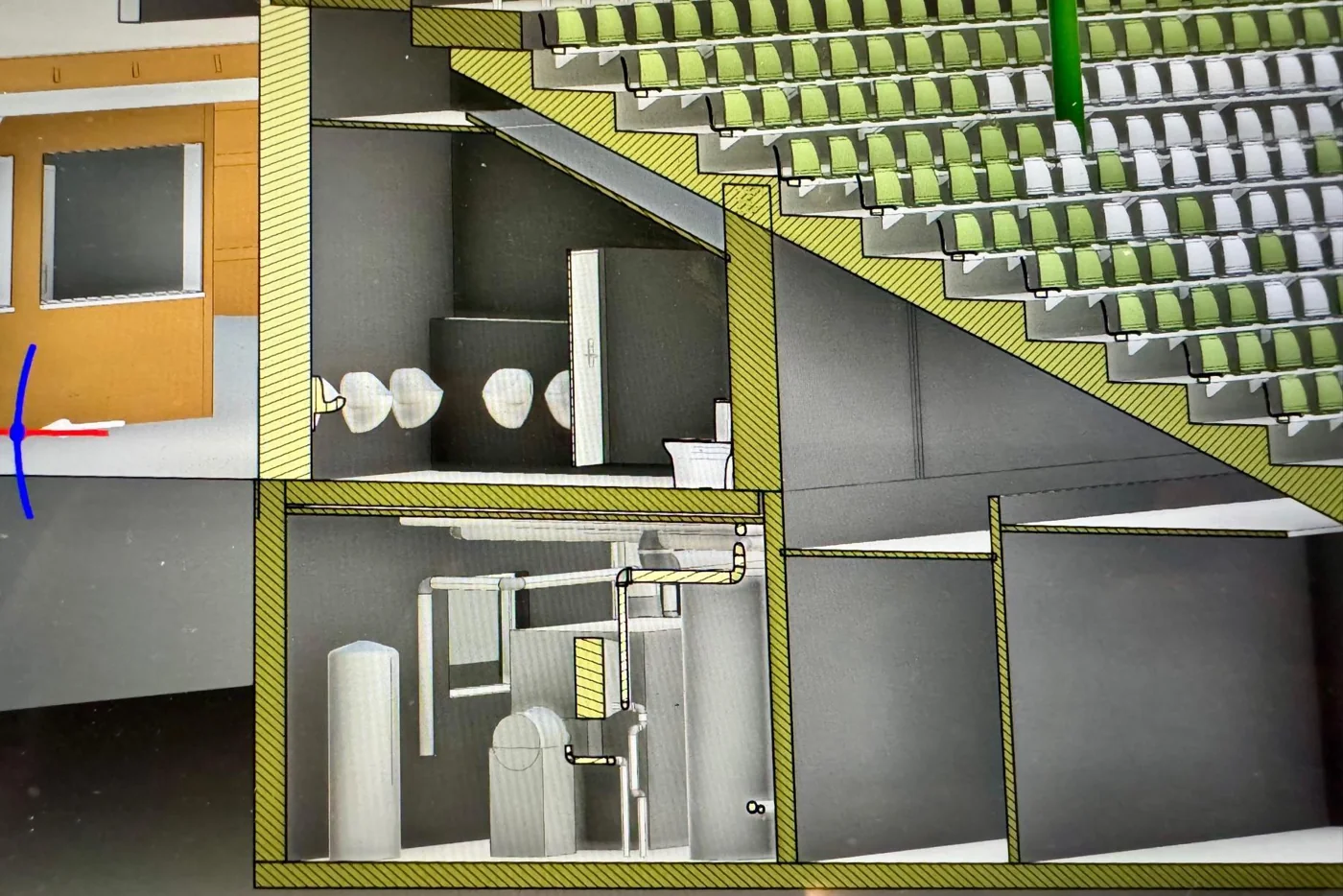
Scan data is processed and converted into a BIM model. The stand view and building section reveal rooms, components and service routes in context.
The model supports refurbishment coordination, spatial clash reviews and preparation for building operations. Virtual views also help present hospitality suites and advertising spaces.
Inside the project
The project film follows the stadium survey through the virtual tour to the BIM model. The model views show how the data can support planning, coordination and building operations.
The film shows the stadium and drone survey, a digital tour of outdoor and indoor spaces, and the BIM model of the stand with views into its rooms.
Starts muted as you scroll. Pause at any time; automatic playback is disabled when reduced motion is preferred.
BIM model in detail
Two views of the same project: the stand as a complete model and a section through its rooms and service routes.
01 / BIM
The stand in BIM: view building components and spatial relationships together.
Enlarge view ↗02 / BIM
Section through the stand: review rooms, components and pipe routes in context.
 Enlarge view ↗
FROM SURVEY TO APPLICATION
Use existing conditions, building components and outdoor areas as a basis for refurbishment planning, design coordination, and cost and quantity estimates.
Bring building components and service routes together in the model. Review spatial conflicts during planning and discuss them with the trades involved.
Locate rooms and components in the digital model as a basis for facility management, maintenance planning and sharing knowledge of the existing building.
Show sponsors’ and VIP areas virtually. Spatial views support presentations of hospitality suites and advertising spaces to prospective partners.
These examples describe applications of the project data. Review scope, modelling detail and further analyses are agreed for each commission.
From capturing existing conditions to BIM and structured building information: tell us about your project.
Photographs, project film and BIM views: GeoScan project materials for VfB Lübeck. Project scope and applications from the supplied presentation slides.